
EN
WILDLIFE MONITORING AND CONSERVATION APPLICATION
WILDLIFE MONITORING AND CONSERVATION APPLICATION
Apr 22, 2025
Use of drones for wildlife monitoring and conservation.
In recent years, the use of drones (UAVs - Unmanned Aerial Vehicles) has significantly increased in wildlife monitoring and species conservation across both terrestrial and aquatic environments. These drones can be programmed to automatically follow individual animals or groups as they move across and within habitats, enabling a wide range of conservation tasks.
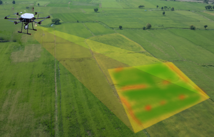
One key application is habitat assessment. By creating spatially extensive maps of vegetation, topography, and other landscape features, drones support analyses of habitat selection and suitability for wildlife. This mapping capability allows researchers to better understand and protect ecosystems.
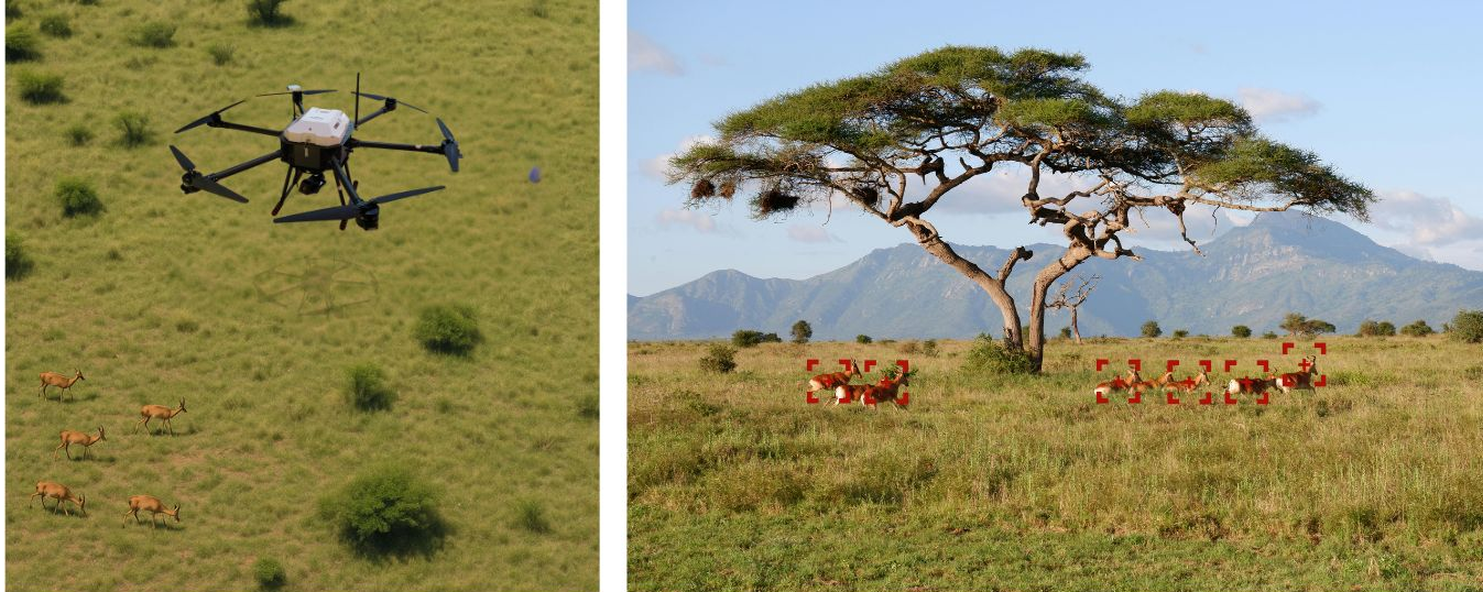
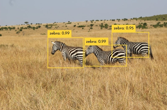
For animal conservation, drones can perform a variety of tasks. For example, UAVs (unmanned aerial vehicles) can carry out estimations of animal population sizes through automated recognition and counting. Moreover, they can observe animal behavior in response to environmental shifts, such as changes in temperature or vegetation, which can serve as an early warning system for potential ecosystem disruptions like habitat loss or climate change effects. In addition, they are able to identify spatiotemporal patterns of cryptic behaviors (hidden or rare behaviors) by flying closer to the animals without disturbing them, allowing scientists to study habits that are usually difficult to detect. They can also influence animal behavior, for example, by guiding or deterring them to avoid areas where hunting is likely or where dangers are present. Drones can collect data on how animals interact with each other (intraspecific) and with other species (interspecific), and can also be used to compare animal behavior when humans are present versus when only drones are observing. This helps to better understand how human presence affects wildlife. Finally, drones are tools for investigating individual body condition and size by using photogrammetric methods and for assessing individual and population-level health status (condition and size offer an understanding of the impacts of environmental conditions and degradation associated with human activities on the health, nutritional status, and population dynamics of a range of species in both aquatic and terrestrial ecosystems). Therefore, drones have become powerful tools in conservation and wildlife management strategies.
The advantages of using drones over traditional methods.
Employing drones for monitoring and mapping offers numerous short- and long-term benefits. Drones can cover larger areas at higher speeds than on-foot surveys and navigate with greater flexibility, particularly multi-rotor drones, which are capable of maneuvering in complex terrains. This capability reduces both operational costs and risks for researchers compared to manned aircraft. Moreover, drones’ smaller size and ability to fly over animals without direct contact minimize disturbance, making them less intrusive than ground surveys.
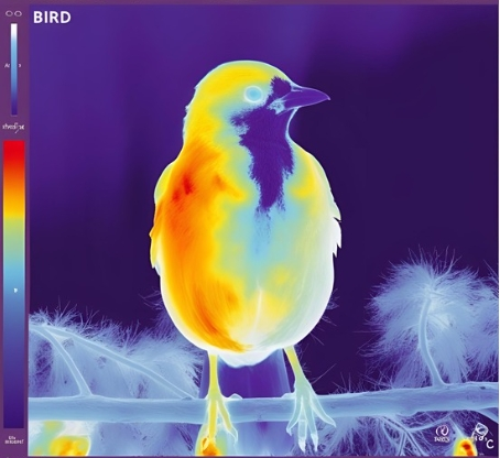
Beyond capturing standard images, drones can be equipped with thermal cameras to study elusive and nocturnal species. These thermal sensors can partially mitigate the challenges posed by canopy cover, as animals’ heat signatures remain detectable even when partially obscured by vegetation. Additionally, drones can carry infrared sensors to enhance detection capabilities in various environments.
Drones can also be fitted with audio recording devices to collect acoustic data, enabling the study of species that communicate through sound. This dual optical and acoustic monitoring facilitates comprehensive behavioral studies, particularly in hard-to-reach environments, providing insights into behaviors that are often elusive or rarely observed.
Furthermore, drones offer temporal coverage, allowing for repeated observations over time to monitor changes in wildlife behavior and habitat use. Their use enhances efficiency and reduces the risk of human injury compared to traditional ground or aerial surveys. As drone technology and data processing systems continue to advance, their application in ecological research becomes increasingly valuable, offering a less polluting alternative to manned aircraft and garnering interest among ecologists.
Which drone to use for wildlife monitoring.
Multirotor drones offer excellent control for detailed surveys. They can hover in place and follow precise flight paths like grid patterns or closely spaced transects, which makes them ideal for studying elusive or partially hidden species. They can fly low, offering very high image resolution (up to 0.01 cm per pixel). Their ability to detect animals is also high, with some studies reporting 100% detection rates.
Fixed-wing drones can fly faster and at higher altitudes than multirotors, covering much larger areas and distances. Thanks to their longer battery life, they are well-suited for large-scale surveys. They are also very stable in high wind conditions, flying in wind speeds up to 45 km/hr without issue.
Combining multirotor and fixed-wing drones brings the best of both worlds: the detailed, high-resolution monitoring of multirotors and the wide-area, long-distance coverage of fixed-wing platforms. Used together, they create a flexible toolset for efficient and comprehensive wildlife conservation and habitat monitoring.
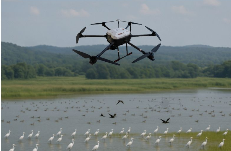
Focus on bird monitoring.
Drones play a key role in monitoring migratory birds by providing low-altitude, non-intrusive surveillance. At Digital Eagle, we use our UAVs to patrol the Nanbei Lake Scenic Area in Haiyan County, a vital stopover for nearly 300 bird species and 150,000 migratory birds each year.
By combining high-resolution cameras and real-time sensors, we help detect illegal hunting and environmental threats, supporting fast, efficient responses. Our efforts have been praised by People’s Public Security Daily and other national outlets for enhancing eco-policing.
Through smart monitoring and data collection, we continue to protect bird habitats and contribute to sustainable ecological development.


Recent Posts

October 26, 2016
The Most Successful Engineering Contractor


Nov 14, 2025
Firefighting Drone Extinguisher for SK-XF07

Contact US
Product Information
Quantity
Unit
Piece
Support order samples, customization, wholesale direct, and complete payment. If the product you look for does not have corresponding customized content, pls fill out the form below to contact us, and we will reply ASAP.